Largest Trip of India: The Big Adventure Trek Everyone Talks About
 Jun, 1 2025
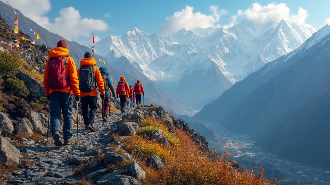
If you want to know about India’s biggest adventure trip, forget the usual city tours. The Great Himalayan Trail, or GHT, is the grand-daddy of them all. It stretches all the way along the Indian Himalayas, crossing several states, cultures, and landscapes. Most people don’t even finish it—just starting is a badge of honor.
This isn’t a clean, easy trail. You’re talking about over 1,700 km of wild terrain. Think freezing passes, lush valleys, yak herders, and the kind of villages where time barely moves. Not something you just sign up for after watching a travel documentary.
If you’ve been craving a challenge that laughs at most weekend hikes, this is it. People who finish sections of the GHT usually walk away with stories that stick for a lifetime. Ready to see what’s in store? Buckle up, because the scale of this trip will blow your mind—and change the way you see adventure in India.
- What is the Great Himalayan Trail?
- Unpacking the Route: Highlights and Surprises
- Facts and Figures: How Big is the GHT?
- Tips to Survive and Enjoy the GHT
- Unique Stories and Challenges from the Trail
What is the Great Himalayan Trail?
The Great Himalayan Trail (GHT) is the boldest trek you can try in India. It's not your typical hiking route. This trail actually connects the eastern tip of Arunachal Pradesh to the western edge of Ladakh, following the spine of the Indian Himalayas. You aren't going to find one clear path with signboards—GHT is more like a patchwork of village trails, old trade routes, and mountain passes, stitched together by people who've been moving through these mountains for generations.
To put it simply, the GHT is the largest trip India can offer if you’re into adventure sports. It's a mega trek, covering about 1,700 kilometers inside India alone. The route snakes through five major states: Arunachal Pradesh, Sikkim, Nepal-bordering West Bengal (Darjeeling area), Uttarakhand, Himachal Pradesh, and Jammu & Kashmir (including Ladakh).
This trail isn’t an official government project. It’s more of an idea—an invitation to connect local trails, go off the beaten path, and experience the real Himalayas. You don’t need permits for every section, but there are places (like Sikkim and across restricted border zones) where rules get strict, and you might need paperwork. Most trekkers break the GHT into shorter legs and cross as many as their lungs and time allow.
If you’re curious about what’s waiting for you on this trail, check out this quick data table about the Great Himalayan Trail in India:
| Fact | Detail |
|---|---|
| Trail Length (India) | Approx. 1,700 km |
| Highest Point (India) | Parang La, ~5,600 m (18,373 ft) |
| Key States Covered | Arunachal Pradesh, Sikkim, West Bengal, Uttarakhand, Himachal Pradesh, Jammu & Kashmir (Ladakh) |
| Main Trekking Season | May to October |
| Time to Complete Full Trail | 4-6 months (for thru-hikers) |
Most trekkers don’t aim for the whole 1,700 km at once. Instead, they pick famous stretches—like the Zanskar valley, the Darjeeling-Sikkim zone, or remote trails in Spiti. Locals, porters, and old-school Himalayan guides play a huge role in helping trekkers stitch together these routes. If you want true bragging rights, the GHT is where you earn them.
Unpacking the Route: Highlights and Surprises
The Great Himalayan Trail (GHT) slices through some of India’s most mind-blowing mountain scenery. You won’t find one fixed path—this route can be pieced together using a network of trails, cutting across high passes and deep valleys in states like Himachal Pradesh, Uttarakhand, Sikkim, and Arunachal Pradesh. Each state brings its own vibe, flavors, and surprises.
The GHT starts (for most trekkers) in Arunachal Pradesh, moving west through Sikkim, then winding into Uttarakhand, Himachal Pradesh, and eventually Ladakh in Jammu & Kashmir. That’s thousands of kilometers facing snow, rain, burning sun, and wild changes in altitude. If you’re traveling east to west, you’ll tackle places like Namcha Barwa base in the east all the way to Siachen Glacier approaches in the far north.
- largest trip India: The GHT stretches over 1,700 km across the Indian Himalayas, making it the longest trek possible here.
- Altitude swings between 1,800 meters in valleys to 6,000 meters at mountain passes.
- Some famous sections include the Markha Valley trek, Pin Parvati pass, Milam Glacier, Kinnaur Kailash, and the legendary Roopkund trek.
- Along the way, expect to cross tribal villages, Buddhist monasteries clinging to cliffs, and dense rhododendron forests in Sikkim.
- Permits are needed in certain areas, especially near the international borders—planning is key.
Here’s a quick look at how the route breaks down by state and its standout spots:
| State | Famous Highlights | Approx. Route Length (km) |
|---|---|---|
| Arunachal Pradesh | Tawang, Mechuka Valley, Namdapha NP | 500 |
| Sikkim | Dzongu, Kanchenjunga Base, Dzongri | 250 |
| Uttarakhand | Roopkund, Milam Glacier, Kedarnath | 350 |
| Himachal Pradesh | Pin Parvati Pass, Spiti, Kinnaur | 400 |
| Ladakh (J&K) | Markha Valley, Zanskar, Hemis NP | 300 |
One surprising thing: the people you meet. From yak herders in Himachal to Buddhist monks in Sikkim, the people living along the GHT are as much a highlight as the views. The weather will keep you on your toes—don’t be shocked if you get sunburned and caught in snowfall on the same day.
Last tip—loads of areas along this route are still off the tourist radar. You might find yourself in places where the only cell signal comes from a satellite phone and your biggest problem is figuring out how to order tea in the local language. That’s part of the adventure, and honestly, it makes every tough day worth it.
Facts and Figures: How Big is the GHT?
When people ask just how massive the Great Himalayan Trail actually is, the numbers hit hard. Stretching over 1,700 kilometers in India alone, the GHT starts from Arunachal Pradesh in the far east and rolls across the rugged backbone of the Himalayas, all the way to Ladakh in the northwest. That’s more than the distance between Delhi and Chennai.
The trail isn’t a straight line either. It weaves through five Indian states: Arunachal Pradesh, Sikkim, Nepal border zones in Uttarakhand, Himachal Pradesh, and Ladakh. The trail mixes remote valleys, high passes, and wild forests, so you’re getting all kinds of terrain, not just mountains. Some passes cross over 5,000 meters above sea level—higher than most peaks in Europe.
If you’re wondering how long it takes, seasoned trekkers who go non-stop say 100 to 120 days (three to four months) if you keep a strong daily pace. Most people, though, break it down into segments over many years. Weather windows are small—don’t even think about the monsoon or deep winter unless you’re an expert with solid backup.
Here’s why everyone talks about the largest trip India has:
- Total distance: About 1,700 km in India, but if you connect neighboring Himalayan trails (like in Nepal), the entire GHT network runs over 4,500 km.
- Average elevation: Many sections stay above 3,000 meters. Prepare for altitude.
- Highest passes: Some go over 5,400 meters, like the Parang La and Lamkhaga Pass.
- Number of days: 100–120 for full trek, if you’re pushing hard. Realistically, most take years doing it in pieces.
- States touched: Arunachal Pradesh, Sikkim, Uttarakhand, Himachal Pradesh, Ladakh.
This trail isn’t for record-breakers alone—just standing at one of those high passes makes you realize how wild and raw it all is. If you want numbers, the GHT delivers, but once you’re out there, the stats start to feel a lot more real with every step.
Tips to Survive and Enjoy the GHT
The Great Himalayan Trail isn’t some quick hike you finish in a week. It takes serious prep—even hardened trekkers get caught off guard. If you want to make it through any stretch of the GHT, you need to start smart and stay sharp the whole way.
- Largest trip India requires more endurance than your standard trek, so train for at least a few months before stepping onto the trail. Walk long distances with a loaded backpack. Test yourself on steep stairs, muddy paths, and uneven ground.
- Break in your boots—seriously, don’t take new shoes unless you love blisters. Go for waterproof ones. Lightweight gear is your best friend; ditch anything you “might” use. For clothing, layer up instead of relying on one thick jacket. The weather will turn without warning.
- Water is tricky on the GHT. Many sections don’t have regular streams, especially farther west. Always carry a good water filter or purification tablets. Plan for at least two liters per day—three if you’re pushing hard.
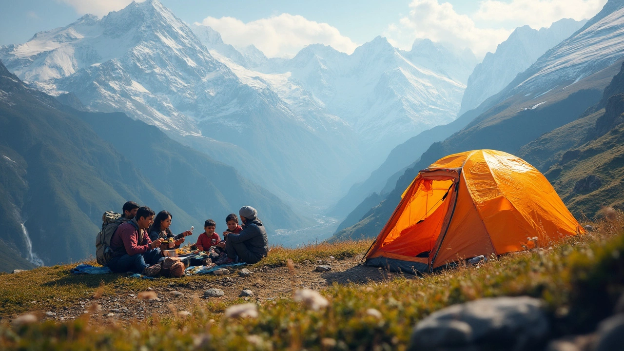
- India’s GHT crosses different cultures, so respect local customs. Learn a few key words in the local language, whether it’s Hindi, Ladakhi, or Nepali. People in these remote villages often share what little they have—treat them with honest respect and you’ll get memories money can’t buy.
- Altitude can mess people up. Don’t race ahead—take time to acclimatize, especially past 3,000 meters. Drink lots of water, eat enough food, and listen to your body. If you feel dizzy or short of breath, don’t tough it out—descend and rest.
Navigation matters. The GHT isn’t marked everywhere. Download offline maps, carry a GPS, and have paper backups. On some stretches, you won’t see another soul for days. It’s wise to check into local police posts or leave your plans with someone in case things go sideways.
Lastly, eat well. You’ll burn thousands of calories daily, so bring food that’s light but rich in energy—nuts, dried fruits, energy bars, and instant meals work well. Say yes to local tea and food when you get the chance. It’s a huge morale boost when exhausted.
Don’t try to rush. The GHT is not just about finishing—it’s about experiencing the most rugged and stunning parts of India up close. Pack smart, respect the people you meet, and accept that the trail always has the final word.
Unique Stories and Challenges from the Trail
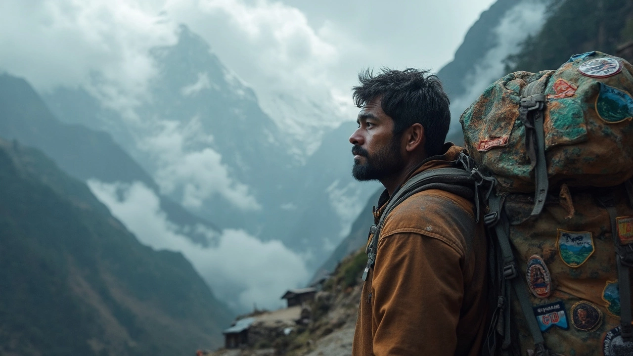
The Great Himalayan Trail isn’t just about distance; it’s about what happens on the way. Forget perfect weather or smooth paths—real life on this route is full of curveballs and memorable moments that people either brag about or admit only after a warm meal back home.
Here’s a fact a lot of folks don’t know: only a small handful of trekkers have finished the entire Indian GHT end-to-end. In 2017, Anshu Jamsenpa became the first Indian woman to set an official record by completing the main section in just one go. Climbers like her talk about unexpected blizzards forcing full stops for days, and supplies running low where even basic food is a luxury.
Wildlife is another part of the adventure. Trekkers report seeing herds of blue sheep, red pandas in Arunachal, and, sometimes, the distant pawprints of a snow leopard. Picture camping out and hearing marmots whistle as an early warning that a bear might be near. A lot of foreign trekkers actually carry bear bells, just in case.
Besides the wild, the major challenge is the sheer logistics. You can walk for five days and not see a shop. That means carrying all food and cooking gear for a week. In Sikkim and parts of Himachal, village homestays are the only roof you’ll find. One hiker, Aditya Gupta, shared that he had to barter with his last protein bar just to get a mug of chai after getting caught in a landslide zone.
| Challenge | Real Example | Impact |
|---|---|---|
| Landslides | 2018 landslide blocked GHT section near Kinnaur, Himachal for 3 days | Trekkers rerouted or waited, supplies rationed |
| Weather changes | Sudden snow in Spiti, 2022, stranded a group of 6 | Emergency evacuation arranged |
| Altitude sickness | Half a group had to turn back near Niti Pass, Uttarakhand | Trip cut short, learned the risk of rushing |
| Navigation errors | No phone signal from Lamayuru to Padum section | One group lost trail, needed rescue by local shepherds |
What really gets to trekkers is the mental game. Weeks with barely any phone connection and repeating meals of dal and rice test your patience. Some say the biggest reward is realizing how tough you really are after pushing through all this—because largest trip India is not about ticking a box, but about who you become along the way.
- Always double-check trail updates—routes shift after storms.
- Pack high-calorie snacks; sometimes, that last bar means everything.
- Talk to locals for tips—they often know shortcuts or safer river crossings.
- If you feel symptoms of altitude sickness, stop and rest, don’t push through.
- Keep a backup power bank or old-school map handy for dead spots.